



My Analysis
Update: Next Week’s Heat Wave Gets Ugly
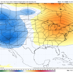
The image above is what the upper-level pattern is going to look like by the middle of next week. A huge heat pump […]
Read More....Weekend Beach Weather

The image above is what the radar may look like Saturday morning Weather Summary If you keep an umbrella close by, Saturday may […]
Read More....Weekend Update – Sunday’s the better day!

The image above is what the radar may look like Saturday morning. Weather Update Sunday by far looks like the better of the […]
Read More....Another Nice Day, But…

The image above is a look at Thursday’s severe weather threat. As of now it is west of the Philadelphia area. Weather Summary […]
Read More....Great Beach Day!

The image above is a look at wind speed and direction Thursday afternoon. Weather Summary Thursday looks like another fantastic day up and […]
Read More....A Beautiful Day!

The image above shows high temperatures today across most of the region. Note the warmest numbers are actually down at the shore. Weather […]
Read More....Here Comes The Heat Again!

The image above is the Philadelphia meteorgram for next week. Weather Summary Other than a couple of rounds of heat here and there, […]
Read More....Back to the Good Stuff!

The image above is a look at the dewpoints Wednesday afternoon. It will feel fantastic out there! Very comfortable! Weather Summary Looking pretty […]
Read More....A Good Soaking

The image above is what the radar may look like later today as another round of showers and thunderstorms swings through. Weather Summary […]
Read More....Another Round of Downpours

Weather Summary Another round of downpours and thunderstorms are on the way Tuesday as the last in a series of disturbances swings across […]
Read More....Flash Flood Threat Shifts South Today

The image above shows possible rainfall totals through the day on Tuesday. We could be looking at a good soaking down at the […]
Read More....Rough Seas and Rip Currents

The water will become very dangerous today for all levels of swimmers. It’s a good idea to just stay out for now and […]
Read More....Flash Flooding Is Becoming a Big Concern for the Delaware Valley

A flash flood watch has been issued this afternoon for the I-95 corridor from New York City to Wilmington and roughly 25-30 miles […]
Read More....Stormy Setup Ahead: Severe Weather Risk Increases Monday

Above is the severe weather outlook by the Storm Prediction Center. The window of concern appears to be 3-11pm. Today has the potential […]
Read More....Midwest Concerns For Dad

The image above is the area of most concern for flash flooding today. Today’s big story is going to be this area of […]
Read More....Another Great Beach Day

The image above shows the westerly breeze developing again Sunday afternoon. Weather Summary Father’s Day looks fantastic for the beaches. Whether you’re in […]
Read More....Keep An Eye On Monday

The image above is a look at projected rainfall totals on Monday. Areas north and west will likely see the most rain. Weather […]
Read More....Arthur Produces Devastating Flash Flooding

Arthur is a classic example of a low-end tropical storm producing high end flooding. Arthur was a very short-lived tropical storm, but it […]
Read More....Gorgeous Weekend Weather!

The image above is a temperature anomaly map for Sunday morning. The first day of summer will start out on the cool side! […]
Read More....Incredible Beach Weekend!

The image above is a look at projected wave heights later this afternoon. Boating conditions are listed below. What an amazing beach […]
Read More....Today’s Severe Risk Downgraded

The SPC decided to downgrade today’s severe weather risk which is a good idea given the amount of dry air that continues to […]
Read More....











