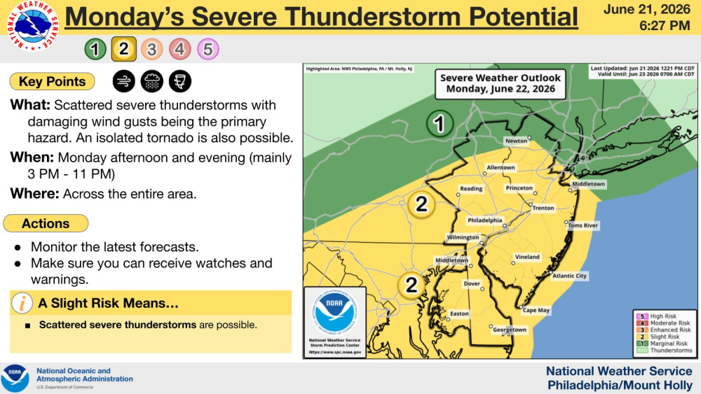
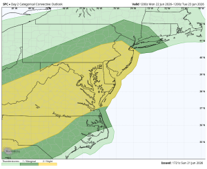
Above is the severe weather outlook by the Storm Prediction Center. The window of concern appears to be 3-11pm.
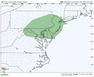
Today has the potential to be an active weather day across the Delaware and Lehigh Valley’s. The SPC maintains their level 2 out 5 severe risk for the entire Philadelphia television market. This risk includes the threat for both damaging straight-line winds and an isolated tornado. The WPC also maintains their elevated flash flood risk. With a tremendous amount of moisture in the atmosphere, rainfall rates could approach 2″ per hour in some of these storms, if not a little higher at times.
The first part of the day looks good. A warm front will lift north during the late morning hours, and a spotty shower or brief spotty thunderstorm is possible. But the main event is going to hold off until later in the day, after 3pm. The evening commute could be very dicey for areas west of the Delaware River.
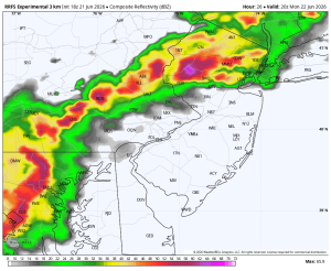
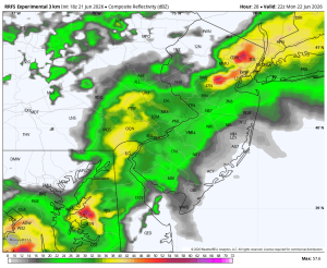
The radar could be peppered with linear segments, bowing segments and supercells all at the same time as the cold front approaches.
What to do if a warning gets issued.
- Severe Thunderstorm Warning – Head indoors, away from windows. Stay off of electrical appliances.
- Tornado Warning – Move to the basement. If you don’t have a basement, move to the center part of your house. Put as many walls in between you and the outside as possible. Stay away from windows, doors and large open rooms. Cover your head and keep your shoes on.
- Flash Flood Warning – Move to higher ground immediately. Do not drive through flood waters.
Categorical Convective Outlook Tornado Outlook
Timing: 4:00pm 6:00pm