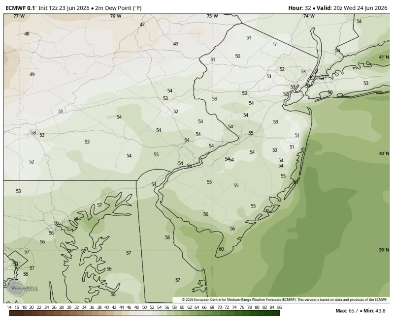
The image above is a look at the dewpoints Wednesday afternoon. It will feel fantastic out there! Very comfortable!
Weather Summary
Looking pretty good out there today! The cold front has cleared the coast, and much drier air continues to work its way into the region from the northwest. You’ll notice a huge drop in the humidity Wednesday to go along with abundant sunshine! Light breezes only add to the comfort! Look for highs in the low to mid 80s. Not too shabby for June 24th!
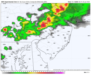
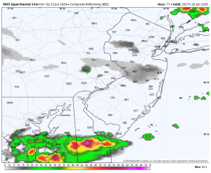
Moving forward though things are going to get a little interesting. There’s a couple of systems (small disturbances in the atmosphere) that will be sweeping through the area. Trying to time them out is the tricky part. Both Thursday and Friday could be impacted by showers or thunderstorms at some point during the day. As of this writing it looks like a late day thunderstorm on Thursday (possibly strong), mainly north and west. And another shower Friday morning followed by a thunderstorm Friday night. But again, if you have outdoor plans, the timing is tricky. A sudden slight shift in direction or increase in speed and all of this changes.
Thursday Evening Friday Evening