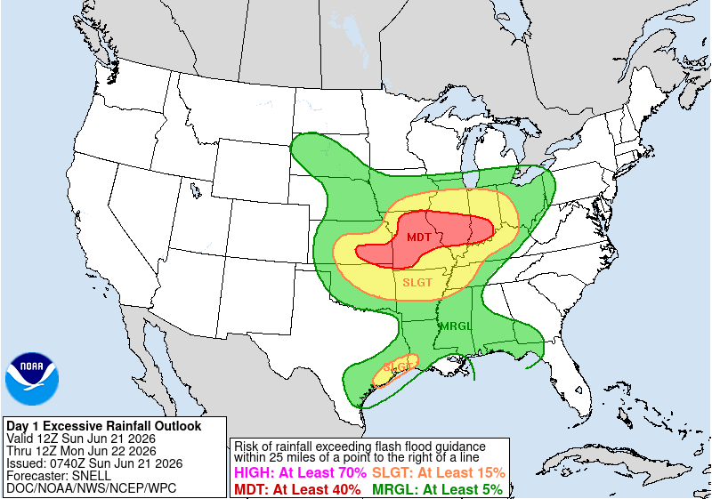
The image above is the area of most concern for flash flooding today.
Today’s big story is going to be this area of low pressure moving east into the Midwest. It may evolve into an MCS (Mesoscale Convective System) later this afternoon. Some of the rain associated with it could be very heavy. There’s a heightened flash flood threat from Oklahoma to Indiana. Locally significant impacts are possible in the area shaded in red.
The NBM (National Blend of Models) shows a general 1-3 inches of rain with isolated heavier amounts to 4 or 5 inches. 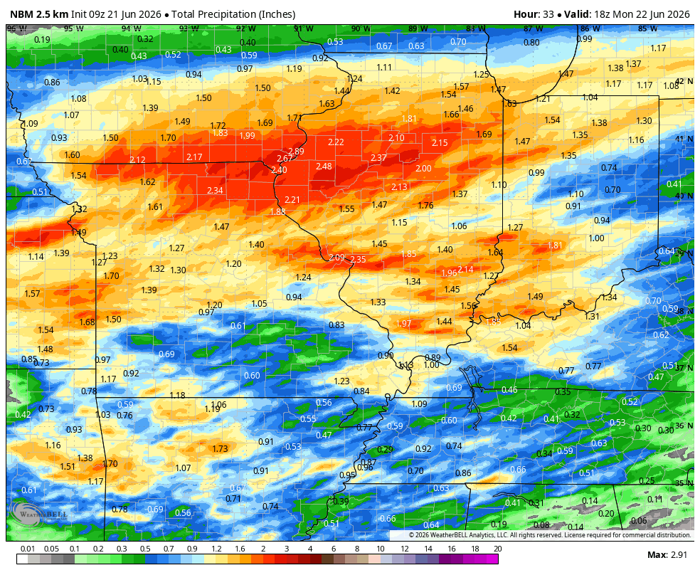
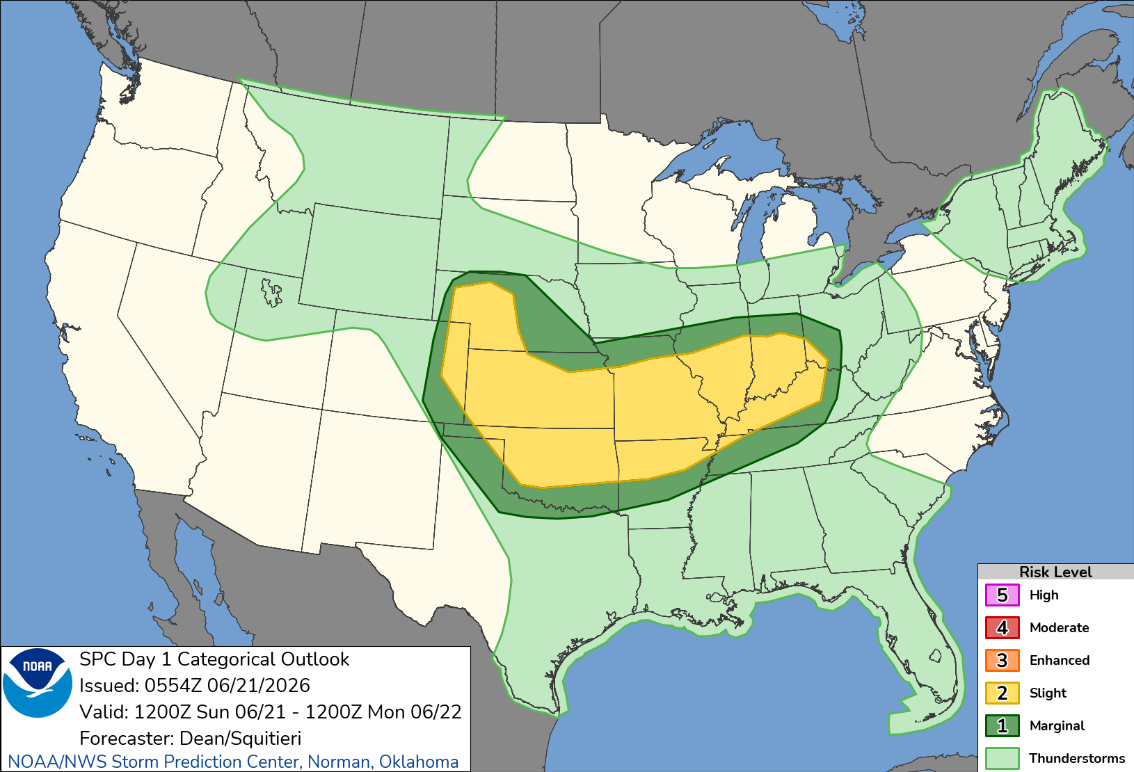
As for severe weather the SPC (Storm Prediction Center) has placed the area in a level 2 out of 5. Scattered heavy thunderstorms not only will produce heavy rain, but they may also create strong, gusty winds and tornadoes. Hall hazards are in play. As of this writing the RRFS (Rapid Refresh Forecast System) was targeting southern Illinois and southeast Missouri as the bullseye. Storms would then push east over the Ohio river and into places like Louisville and Paducah overnight.
The severe threat shifts east and hits the east coast on Monday.