Arthur is a classic example of a low-end tropical storm producing high end flooding. Arthur was a very short-lived tropical storm, but it has produced major flooding impacts across the Gulf Coast and Deep South. While winds just barely peaked at 40 mph (nothing more than a breezy day), the storm’s legacy will be remembered for its torrential rainfall and flash flooding.
Widespread rainfall totals of 5 to 10 inches fell from southeast Texas through Louisianna, Mississippi, Alabama and portions of Georgia. Isolated areas have received between 20-25 inches with rainfall rates between 2 and 3 inches per hour for several consecutive hours. Doppler radar has estimated an astonishing 26″ of rain in just 24 hours east of Cottonport, Louisianna. Numerous Flash Flood Warnings and emergencies were issued as roads became inundated. Several water rescues were reported across the region.
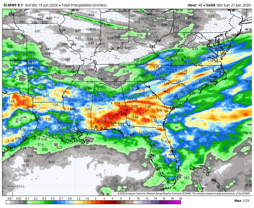
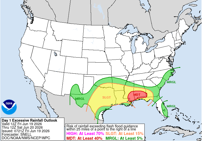
Another round of heavy tropical rain is in store for parts of the Gulf coast today as the remnants of Arthur continue to sweep across the deep south.
Rainfall totals still to come…