



My Analysis
Heavier Rain Moves In Thursday Night
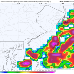
The image above is the lighting flash rate Friday morning. Severe weather is not expected out of this, but there could be a […]
Read More....Tropics – Soon to be Tropical Storm Isaias
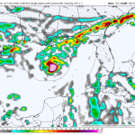
The National Hurricane Center continues to watch an unorganized area of showers and thunderstorms in the southwest Gulf. This area has become a […]
Read More....Nor’easter Pictures – 09/26/2026
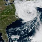
Flooded streets in Sea Isle City – Locals said it was the highest they’ve seen the water since Super Storm Sandy […]
Read More....Sunday Could Be Wet For Some
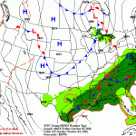
Weather Summary The latest computer guidance develops a very broad, weak area of low pressure around the Virginia Capes and slides it east […]
Read More....Nor’easter Stats
Peak Wind Gusts Surf City: 74 mph Harvey Cedars: 69 mph Ship Bottom: 67 mph Barnegat Light: 61 mph Avalon: 61 mph Wildwood: […]
Read More....Weekend Nor’easter
An early season nor’easter will be hammering the northeast coast this weekend from the Delaware beaches to the Gulf of Maine. A strong, […]
Read More....Coastal Flooding – Significant Beach Erosion
The strong onshore flow and rough surf will continue to cause coastal flood problems down the shore for the rest of the week. […]
Read More....Tuesday’s Beach Forecast – Not A Nice Day
Weather Summary Cloudy, cool and windy today with on and off light rain and drizzle. The onshore pounding begins today with a strengthening […]
Read More....The Shore Will Take A Pounding This Week
Regardless of whether or not the late week nor’easter materializes, the Jersey Shore will take a pounding this week. A strong gradient wind […]
Read More....Monday’s Beach Forecast
Today is the nicest day of the week! Partly sunny and breezy with gusts up to 20 mph. The rest of the week […]
Read More....Sunday’s Beach Forecast
Beach Forecast UV Index: High (Sun and clouds) Temperature: 78 Winds: S 10-15 mph Rip Current Risk: Moderate Ocean Temperature: 72 Thunderstorm Risk: […]
Read More....Saturday’s Beach Forecast -Beautiful!
A really nice start to the weekend! Sun and clouds, breezy and comfortable! Beach Forecast UV Index: High Temperature: 73 Wind: NE 15-20 […]
Read More....Friday’s Beach Forecast
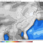
The boundary that will eventually lower the humidity has slowed a bit this morning. Therefore, today is still expected to be on the […]
Read More....Thursday’s Beach Forecast

Beach Forecast UV Index: High (Sun and clouds) Temperature: 79 Wind: S 5-10 mph Rip Current Risk: Low Ocean Temperature: 73 Thunderstorm Risk: […]
Read More....Weekend Football Forecast – Sloppy For Some
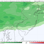
If you’re debating on whether or not to make those outdoor plans on Saturday or Sunday here in the Philadelphia area, I’ll make […]
Read More....Beach Forecast – Next Two Days
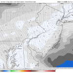
Beach Forecast Through Wednesday UV Index: High (Mostly Sunny Skies) Temperatures: low to mid 70s Winds: E 5-10 mph Rip Current Risk: Low […]
Read More....The Week Ahead – Monday Update
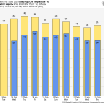
WEATHER SUMMARY This is a beautiful week around the Delaware and Lehigh Valleys. Climatologically speaking September is one of the quietest months of […]
Read More....Flood Watch

Weather Summary A FLOOD WATCH has been issued for the I-95 corridor from Wilmington, Delaware through southern Connecticut. Downpours and heavy thunderstorms will […]
Read More....Sunday’s Beach Forecast – Messy Start!
Sunday starts out gloomy with leftover downpours and a thunderstorm. Some of the rainfall could be heavy. Conditions will improve during the afternoon […]
Read More....Saturday’s Beach Forecast – Wildwood Air Show

Overall, it looks like a pretty nice day for the Wildwood Air Show! Increasing clouds and humidity during the day, but we should […]
Read More....Weekend Forecast

Weekend Forecast Saturday Increasing clouds. It will be warm and moderately humid with highs in the low 80s. Overall, this is a very […]
Read More....











