



My Analysis
Friday’s Beach Forecast – A Nice Day!

The image above is a look at wave direction and height this afternoon. Beach Forecast UV Index: High (Sun & Clouds) Temperature: 78 […]
Read More....Thursday – Big Thunderstorms Developing
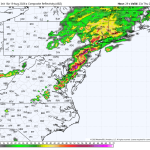
The image above is a look at what the radar may look like around 7pm across the Mid-Atlantic and portions of the Northeast. […]
Read More....Thursday’s Beach Forecast

The image above is what the radar may look like by 8:00pm Thursday. All indications are that a broken, but potent line of […]
Read More....Wednesday’s Forecast
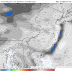
The image above is a look at the light westerly wind speeds today. The westerly wind lowers the humidity. Another great day around […]
Read More....Wednesday’s Beach Forecast

Beach Forecast UV Inde: Very High (Sunny Skies) Temperature: Mid 80s (Moderately Humid) Wind: SW 5 mph Rip Current Risk: Low Ocean Temperature: […]
Read More....Tuesday’s Forecast – Stellar!
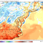
Tuesday looks like an incredible day around the Delaware and Lehigh Valley’s! One of those full sun type days with lowering humidity and […]
Read More....Tuesday’s Beach Forecast

Beach Forecast Mostly sunny and warm and a light sea breeze kicking in during the afternoon. Areas west of the Garden State Parkway […]
Read More....Hotter, More Humid Monday
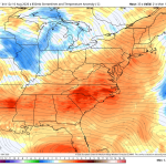
Weather Summary Conditions will gradually improve with early morning clouds and leftover showers giving way to mostly sunny skies for a time during […]
Read More....Monday’s Beach Forecast – Improving

Weather Summary Conditions improve during the day. Morning clouds and leftover showers will eventually give way to some sunshine during the afternoon. It […]
Read More....Sunday Beach Report – Showers Moving In Late

Beach Forecast UV Index: Low (Mostly cloudy with showers developing later in the day) Temperature: Low 80s Wind: S 5-15 mph Rip Current […]
Read More....Sunday – Wet Weather Moving In By Afternoon
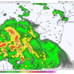
Weather Summary The forecast for Sunday keeps changing as the modeling continues to go back and forth with the track of a disturbance […]
Read More....Saturday’s Beach Forecast – A Fantastic Day!

Beach Forecast UV Index: Very High (Mostly sunny skies) Temperature: Low 80s Wind: ENE 5-10 mph Rip Current Risk: Low Ocean Temperature: 73 […]
Read More....Tropics Getting Active: 92L & 94L
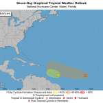
The image above is a look at the two storms the NHC is monitoring in the middle of the Atlantic; Invest 92L and […]
Read More....Friday’s Beach Forecast – Good Day For The Boaters!

The image above is a look at the expected wave heights this afternoon. Nice and flat out there, not much wave action (near-glassy). […]
Read More....Weekend Preview
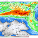
As of this writing the computer guidance is starting to lean towards a 50/50 weekend with Saturday being the better of the two […]
Read More....Thursday’s Beach Forecast – Looking Good!
Beach Forecast UV Index: Very High (Sunny Skies) Temperature: Upper 80s Wind: W 5-10 mph Rip Current Risk: Low Ocean Temperature: 73 Thunderstorm […]
Read More....Isolated Severe Risk Tonight
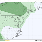
The SPC (Storm Prediction Center) has placed Philadelphia and areas to the west in a LEVEL 1 out of 5 severe weather risk […]
Read More....Wednesday’s Beach Forecast – Nice Day!
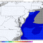
Beach Forecast UV Index: High Temperature: Mid 80s Wind: NW-E 5-10 mph Rip Current Risk: Low Ocean Temperature: 73 Thunderstorm Risk: 0% […]
Read More....More Storms On Tuesday?
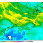
The SPC is gearing up for a huge severe weather day out west as most of the high-resolution forecast data shows an MCS […]
Read More....Tuesday’s Beach Forecast
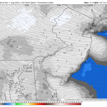
Beach Forecast UV Index: Very High Temperature: Upper 80s Wind: W 5-10 mph Rip Current Risk: Low Ocean Temperature: 72 Thunderstorm Risk: 20% […]
Read More....Severe Risk Increasing Monday
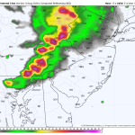
Weather Summary It looks like yet another stormy later afternoon/evening across the Delaware and Lehigh Valley’s with the SPC upgrading a large part […]
Read More....











