



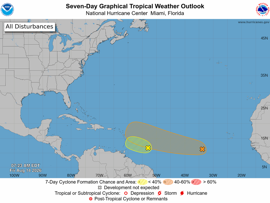
The image above is a look at the two storms the NHC is monitoring in the middle of the Atlantic; Invest 92L and Invest 94L
Weather Summary
There are two systems that we’re closely monitoring in the Atlantic basin. The National Hurricane Center has labelled them Invest 92L and Invest 94L. Both are currently located over the MDR (Main Development Region). Invest 92L is the front runner approximately 24 hours away from the southern Leeward Islands (as of this writing). Invest 94L is roughly three to four days behind Invest 92L.
So where are they heading?
Invest 92L
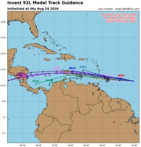
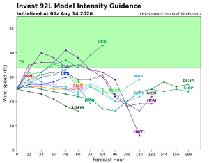
Located near the Lesser Antilles. It’s a broad unorganized area of showers and thunderstorms. Gradual strengthening is likely over the weekend and Invest 92L could become a tropical storm. As it travels west though it will be encountering a lot of wind shear and dry air that will prevent it from becoming a dangerous storm. Invest 92L is expected to keep moving west bringing heavy rain and gusty winds to the Lesser Antilles Friday night into Saturday. Then it moves into the Caribbean as a super inflated rainstorm, nothing more.
This storm is not a threat to the United States.
Invest 94L
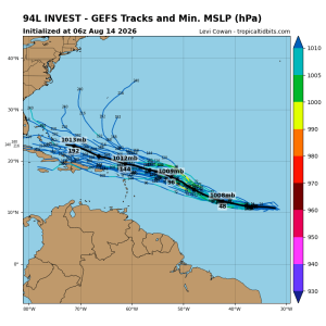
This is the one to watch closely. Currently located several hundred miles southwest of the Cabo Verde Islands, it’s a broad unorganized area of low pressure. The NHC believes conditions should be more conducive for gradual development and strengthening over the next couple of days. Unlike Invest 92L which is moving toward increasing wind shear and dry air, Invest 94L has more runway over the tropical Atlantic. That gives it time to organize and strengthen.
What about the east coast? Invest 94L is still very far east, and its eventual track will depend heavily on the strength and orientation of the subtropical ridge. A stronger ridge would tend to keep it farther west, while a weakness in the ridge could allow it to turn more northwestward. However, because this system hasn’t even developed yet, model-specific landfall tracks this far out should be treated with a very large grain of salt.
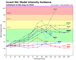
Graphics supplied by Tropical Tidbits





