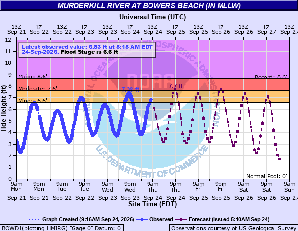



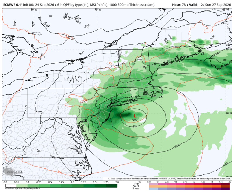
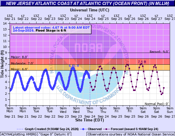
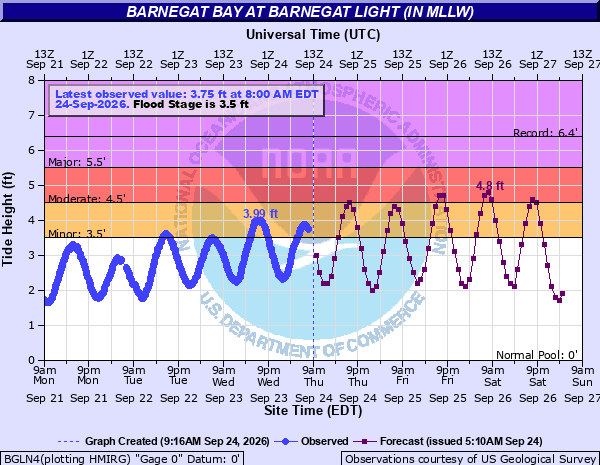
The strong onshore flow and rough surf will continue to cause coastal flood problems down the shore for the rest of the week. We’ve already seen MODERATE tidal flooding in some areas yesterday with more expected today and tomorrow. It is possible, depending on the track of the nor’easter, that we could even see some areas of major tidal flooding especially on the back bays.
A COASTAL FLOOD WARNING has been issued for all ocean front beaches through Saturday morning. One to two feet of inundation is expected in low-lying areas near shorelines and tidal waterways. Many roads will become impassable during times of high tide. Some damage to vulnerable structures may occur as well.
A HIGH SURF ADVISORY is also in effect for the ocean front for waves up to 10 feet!
A high rip current risk has also been issued for all area beaches. STAY OUT OF THE WATER!
Significant beach erosion is likely – breaching of sand dunes is possible. Do not drive your vehicle through flood waters. The water will likely be deeper than you think, and you don’t know the condition of the road underneath. You will be putting yourself in danger and your vehicle may be damaged.
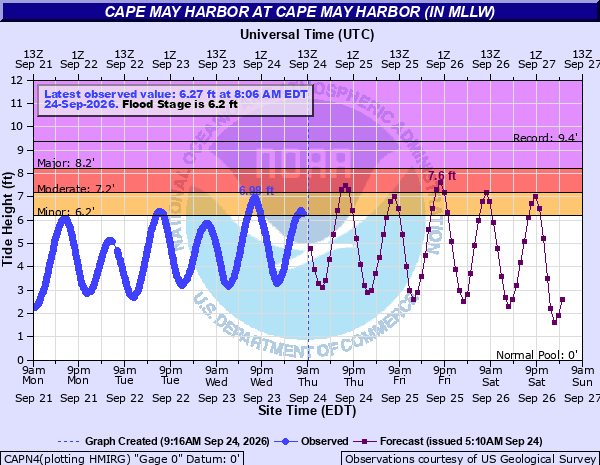
Cape May Harbor Tide Levels
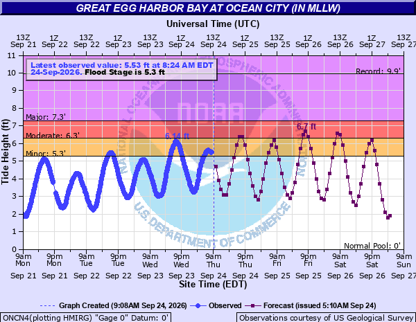
Great Egg Harbor Bay at Ocean City Tide Levels
Atlantic City
Barnegat Bay at Barnegat Light
Murderkill River at Bowers Beach