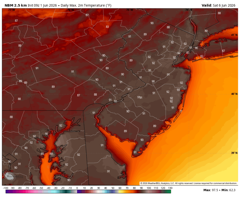
It looks like we’re getting ready to turn up the thermostat again later this week. It probably won’t be as bad as the previous stretch of hot weather we dealt with about a week ago, but certainly hot enough. There are some indications that we could be headed towards another heat wave. Below is a look at the NBM (National Blend of Models).
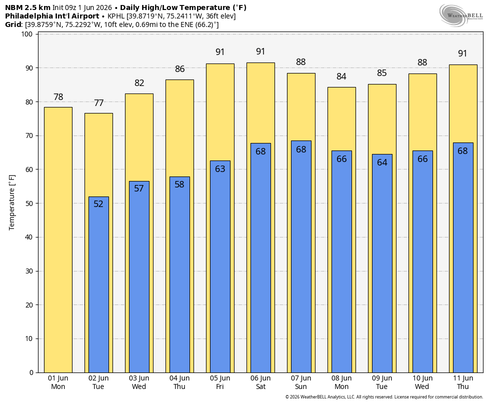
Sunday’s high temperature will depend on the timing of a cold front and thunderstorms. The two global models (ECMWF, GFS) are split right down the middle. The ECMWF (European model) has another day with high temperatures in the 90s while the GFS pushes the front through very early in the day and drops the highs down into the 70s. However, that same GFS shows a long, blistering heat wave during the middle of June.
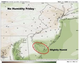
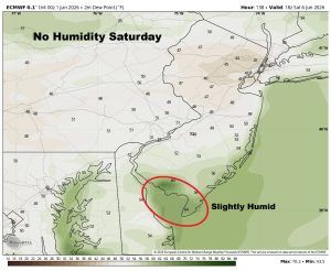
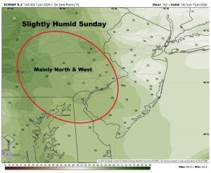
Fortunately, the humidity doesn’t look bad at all. It will be a little humid on Friday and Saturday for areas closest to the water (Delaware Bay, Jersey shore). Otherwise, these are just hot days with no real heat index to deal with. On Sunday, with a cold front advancing east and showers and thunderstorms pushing through, the humidity will come up a little bit.