Right now, there does not appear to be a significant, well-defined tropical threat in the Gulf next week based on the latest outlooks from the National Hurricane Center. The official tropical outlook currently shows no active tropical cyclones or strong areas of concern. With that being said the ensembles have been and continue to hint at something trying to organize north of Havana and west of the keys the first week of June.
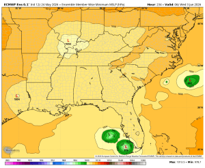
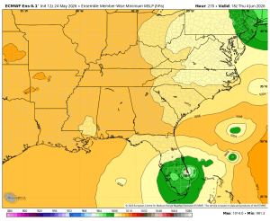
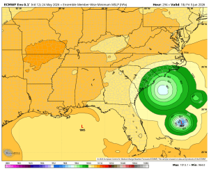
Forecast models can sometimes hint at weak low-pressure development 5-10 days out, but those signals frequently change as model accuracy drops dramatically after five to six days out. What you’re looking at above is the ECMWF ensemble set which usually does better at this range than the individual models. Notice the greens areas near Florida. The ensemble is sniffing something out.
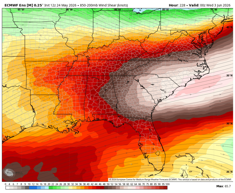
We do have some limiting factors including lingering upper-level wind shear and dry air intrusions. You can clearly see the red and orange colors stretching across the image below from southwest to northeast. That’s all wind shear. Favorable conditions for tropical development include wind shear of 10 knots or less. This is 30 to 40 knots which is quite a bit more than that.

Sea surface temperatures in the Gulf are already plenty warm enough to support development so if this shear relaxes and a disturbance is able to form; things could organize pretty quickly near the coast. Keep an eye on this if you have interests in south Florida the first week of June.