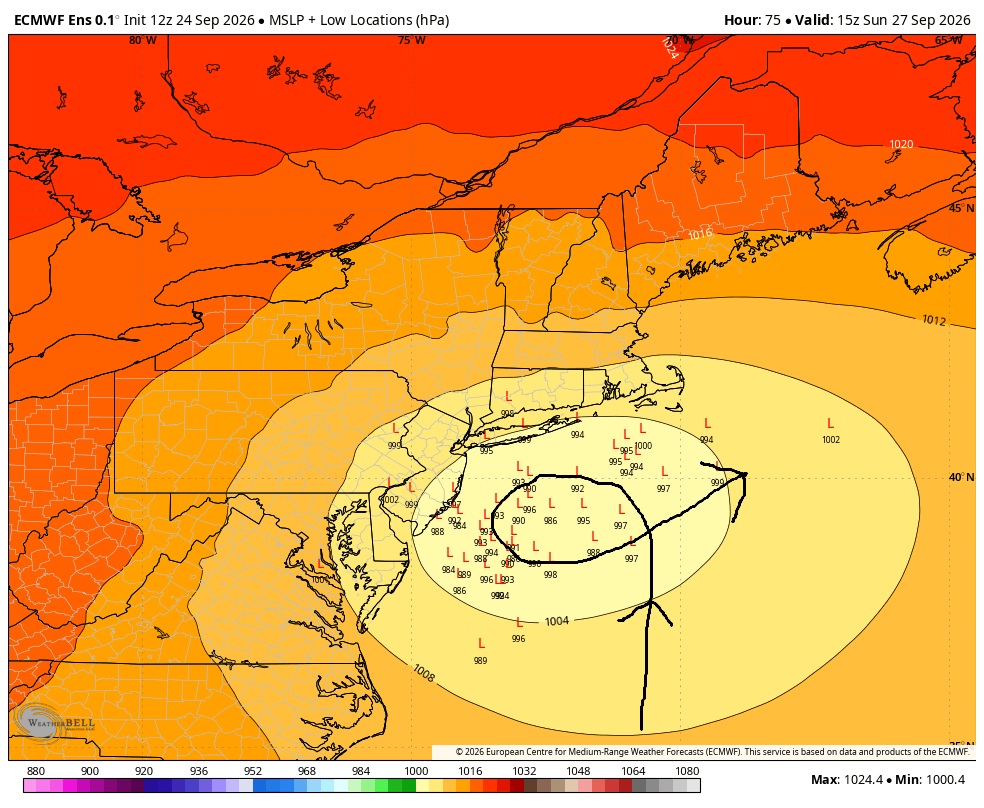



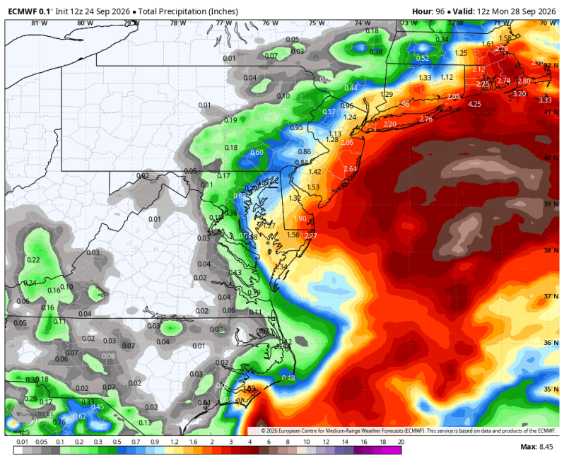
An early season nor’easter will be hammering the northeast coast this weekend from the Delaware beaches to the Gulf of Maine. A strong, persistent onshore wind (flow) will produce moderate coastal flooding and large battering waves which will create a significant amount of beach erosion. Winds could gust over 60 mph in coastal southern New England. Heavy rain will also break out in areas closest to the coast from Atlantic City north to Cape Cod.
For the Jersey Shore… the National Weather Service is highlighting
1. Strong NE winds, gusts 40-50 mph
2. 10-14 foot seas offshore
3. Multiple rounds of tidal/coastal flooding
4. Dangerous surf and rip currents
5. Significant beach erosion, with the possibility of dune breaching in vulnerable areas
Why the coastal flooding could be impressive
This isn’t just a quick storm that blows through. The northeast wind is expected to persist for several days, continuously pushing the water toward the coast and into bays and tidal rivers. That means flooding can occur during multiple high-tide cycles, allowing water to build rather than completely drain between events. And there’s another factor: the full moon this weekend means higher astronomical tides, which can amplify the coastal flooding threat.
For southern New Jersey
The Jersey Shore is likely to take the brunt of it. Inland areas should see a considerably less severe storm. although persistent wind and rain can still cause some problems. Current NWS guidance has roughly 1-1.5 inches of rain along the northern NJ coast, with lower amounts farther inland. Some coastal communities could see as much as 2 inches. The storm is expected to linger into Sunday, gradually weakening as it pulls away Monday.
The ECMWF ensemble shows the nor’easter making a loop off the Jersey coast. The closer it gets to the coast, the worse the impacts will be and vice versa.