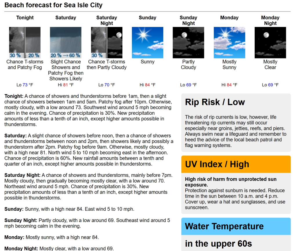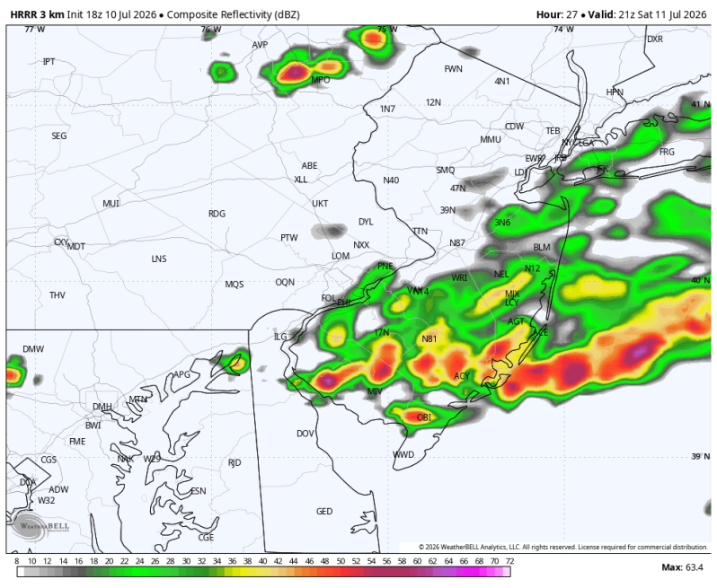
The image above is what the radar may look like by 5pm Saturday
Weather Summary
The first part of the day looks pretty good with a combination of sun and clouds (more clouds than sun at times). But a disturbance will swing through later in the day and bring a few downpours and thunderstorms to the area (after 2pm). Dinner plans could be impacted. A sea breeze will kick in during the afternoon. It’s light at only 5-10 mph, but at least it’s a cooling breeze.
Also, watch the fog during the early morning hours. Its patchy, but likely dense in some areas.
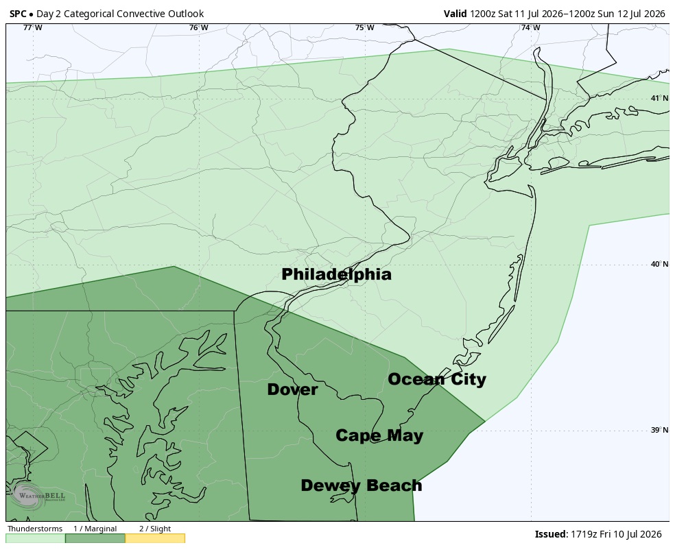
*There is a slight chance for severe weather from Atlantic City, south through Cape May and the Delaware beaches. *
The Storm Prediction Center has issued a severe risk level 1 on a scale of 1 to 5
Beach Forecast
UV Index: High
Temperature: 80
Winds: East 5-10 mph
Rip Current Index: Low
Water Temperature: 68
Boating Forecast
Winds: NE 10-15 kts.
Seas 2-3 ft.
High Tide Times
Beach Haven Crest: 6:40am
Atlantic City: 3:47am, 4:28pm
Ocean City 9th Street Bridge: 4:43am, 5:20pm
Wildwood Crest: 3:57am, 4:41pm
Bethany Beach: 4:48am, 5:50pm
Fortescue: 5:4am, 6:33pm