Most of Sunday looks fine with just a combination of sun and clouds. It should be a great pool day out there! Just don’t forget about the sun because the burn index is really high. As a cold front approaches from the west, the southerly flow will increase. This will pump in the heat and humidity again. High temperatures up and down the I-95 corridor will top out in the low 90s with heat indices in the mid 90s. So, it will be a bit uncomfortable out there at times.
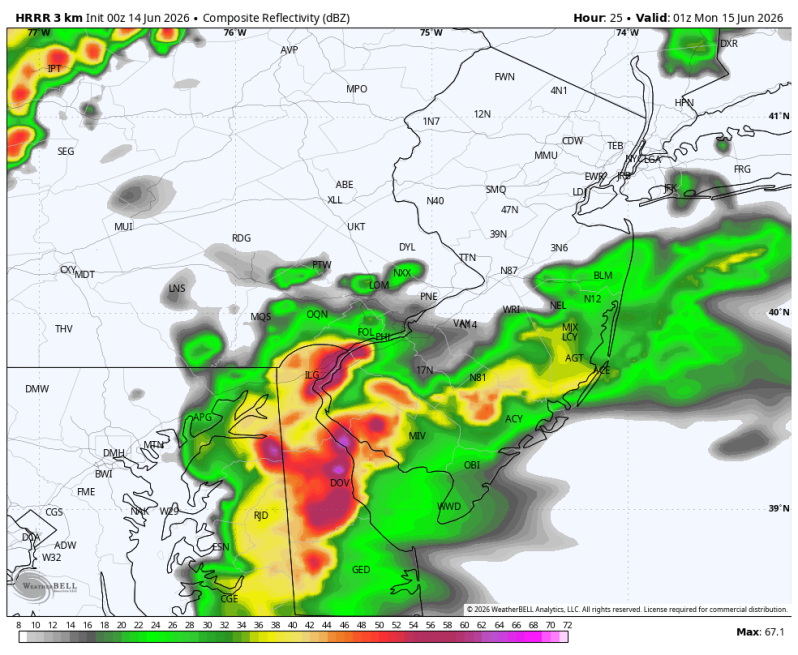
After 4pm showers and thunderstorms will begin firing up. Especially for areas west of the Delaware River. Some of these storms have the potential to produce big winds again. It’s possible some of you may see 60-65 mph gusts out of this. Winds at this strength are known for downing trees and power lines so a few power outages are possible.
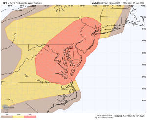
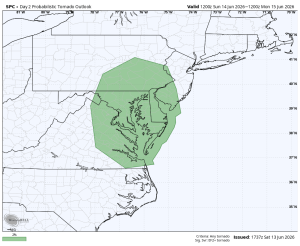
The primary threat will be strong, potentially damaging straight-line winds. There is a tornado threat though. It’s low, but a threat, nonetheless. Timing 4-11pm from west to east.
I would expect a Severe Thunderstorm Watch to be issued at some point during the day. Please stay weather aware and make sure you have multiple ways of receiving warnings.
Wind Threat Tornado Threat