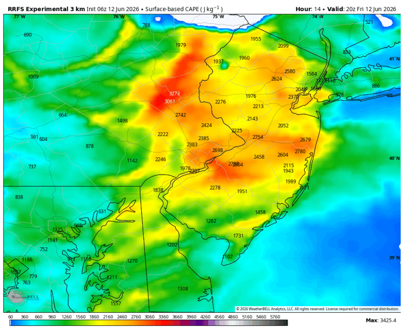
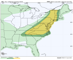
There were over 650 reports of high winds and wind damage across the United States yesterday with many of those reports coming from the state of Pennsylvania. Another round is potentially on the way this afternoon. The Storm Prediction Center has placed a large chuck of the eastern half of the United States (from Hartford to Raleigh) in a level 2 out of 5. Scattered, widespread heavy thunderstorms are likely in the area shaded in yellow below.
Categorical: 2 out of 5 Strong Wind Threat Elevated
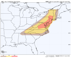
Like yesterday, strong to potentially damaging straight line winds will be the biggest concern. The hail and tornado threats are both thankfully very low. Most of the damage reports yesterday were downed trees and power lines. So, since this is a similar setup, I would keep my electronic devices fully charged throughout the day and park your car in the garage. If you don’t have a garage, try to park your car away from old trees.
What’s interesting is most of the latest computer guidance shows the bulk of the heavy weather today passing by to our north and to our south. Hopefully that trend continues. We certainly could use the rain as the US Drought Monitor showed even the drought getting worse by the week here in the Delaware Valley. But we definitely don’t need the damaging winds.
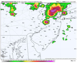
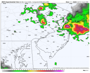
Future radar: 7pm Future radar: 9pm