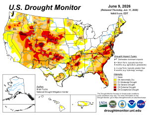
The US Drought Monitor updates every Thursday. The categories include abnormally dry (which is not technically a drought category), moderate, severe, extreme and exceptional. Notice the red beginning to show up across south Jersey now. That’s extreme drought conditions.
The current update is posted below. The complete update can be found in the FORECAST tab on the toolbar (at the top of the page) in the drop-down menu (LOCAL section).
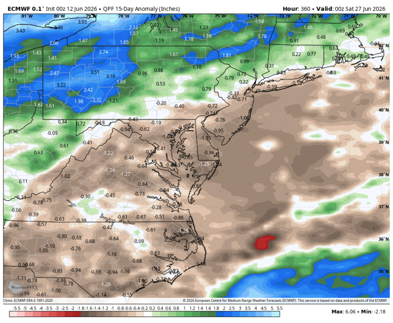
Dry conditions keep getting worse and worse here in the Delaware and Lehigh Valleys.
We’re not in a burn ban and we do not have any water restrictions as of now. But if we continue down this road, restrictions may be implemented soon.
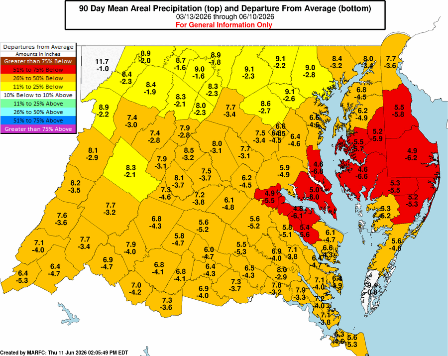
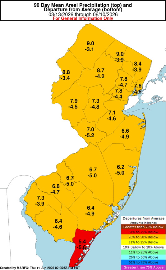
Below is a look at the 90-day deficit for the Garden State of New Jersey. Notice the read beginning to show up now in Cape May County. The county as a whole is nearly 6 inches below average.
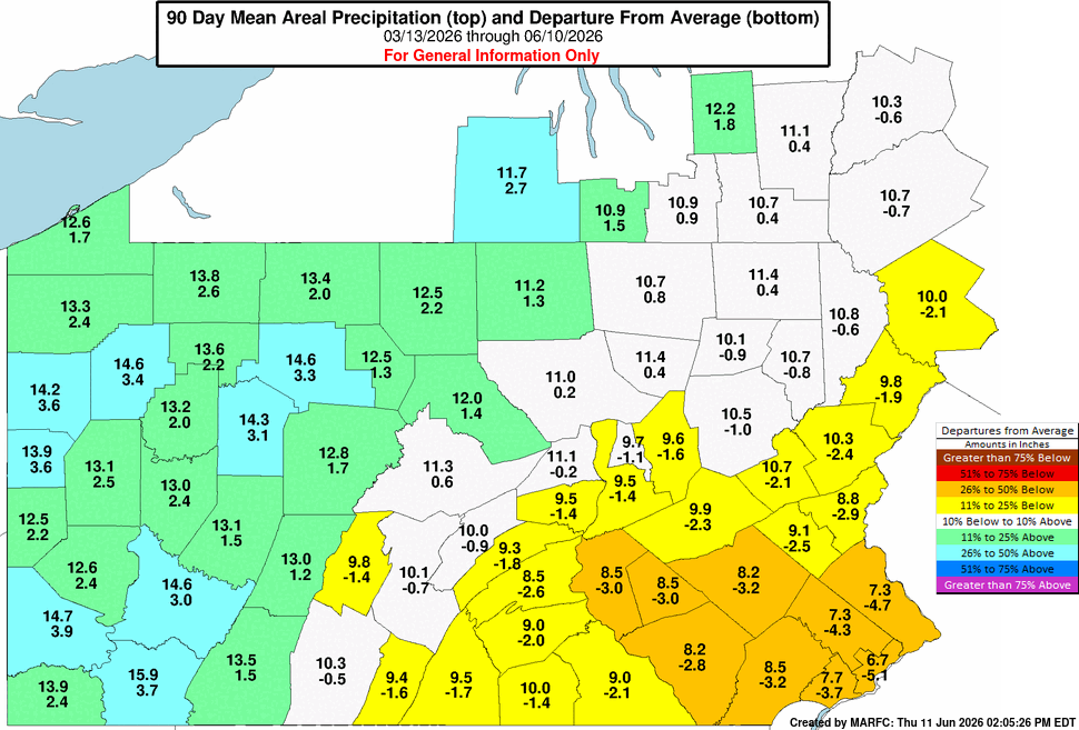
Below is a look at the 90-day deficit for Pennsylvania. Many of our southeastern Pennsylvania suburbs are between 3 and 5 inches below average. Surprisingly, the western half of the state into upstate New York is actually in a surplus. That’s where the general storm track has been.
Below is a look at the 90-day deficit for the state of Delaware. Most of the state is between 4 and 6 inches below average.