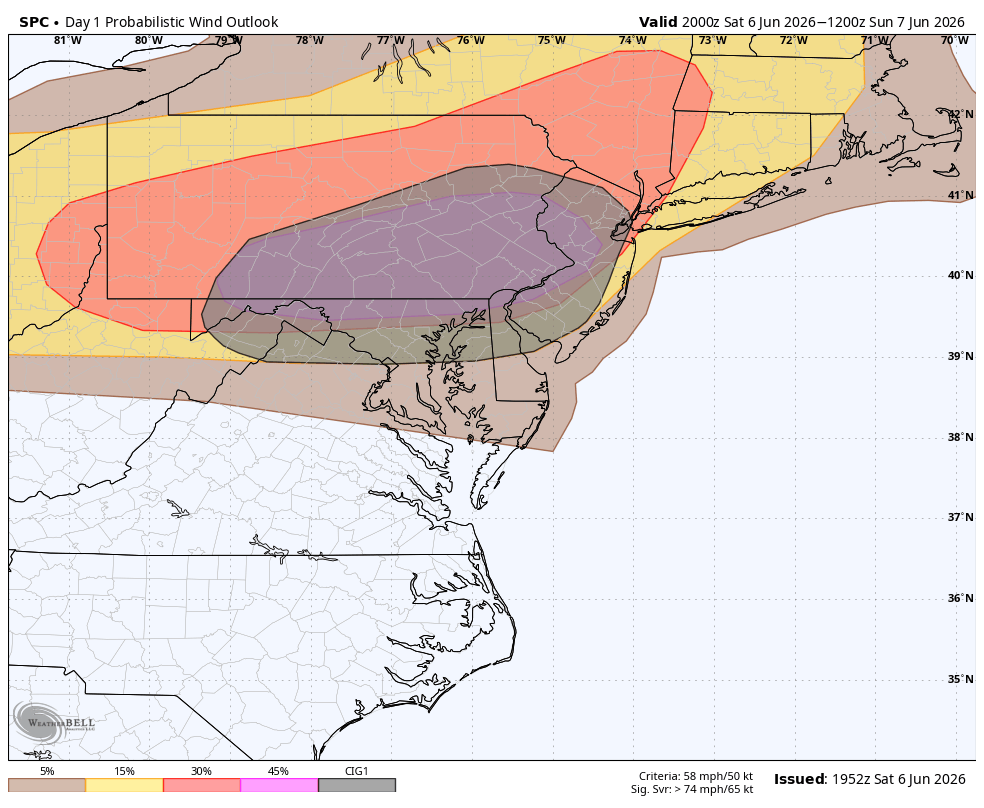
The Storm Prediction Center has upgraded this evening’s severe threat to ENHANCED. A level 3 out of 5. Strong winds will be the primary threat. These storms, approaching from the west, have a history of wind damage that stretches from central Ohio to central Pennsylvania. Some of the damage reports include uprooted and downed trees, minor structural damage and power outages. There have also been a few tornadoes reported west of Harrisburg. Some of the straight-line wind reports have exceeded 70 mph! CAMS data would suggest the Lehigh Valley has the greatest chance of seeing severe weather out of this. However, a large part of the viewing area is now in the level 3 (orange).
Timing: 6pm to 10pm (west to east)
What to do in a Severe Thunderstorm Warning: Head indoors. Stay away from windows and off of electrical appliances.
What to do in a Tornado Warning: Head to the basement or the center part of your house immediately.