Weather Summary
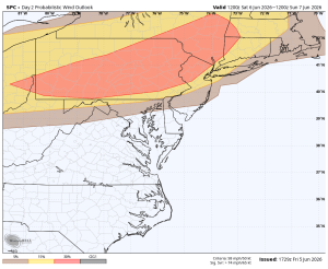
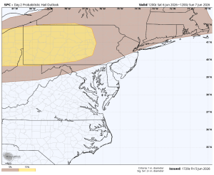
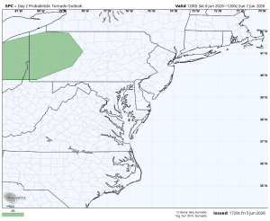
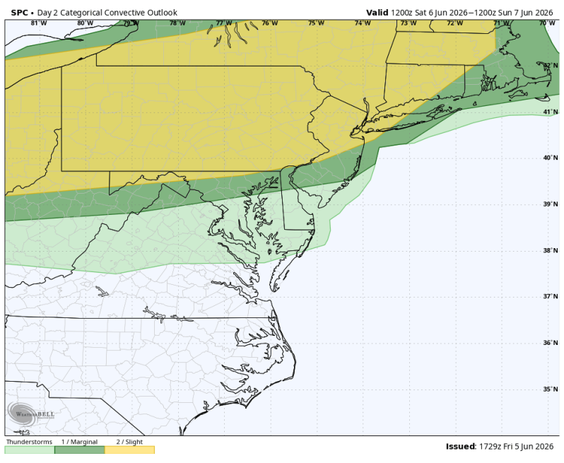
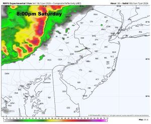
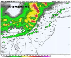
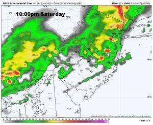
For the Delaware and Lehigh Valley’s the threat for severe weather will increase late Saturday afternoon and evening as a cold front approaches from the west. Hot and increasingly more humid conditions will help fuel scattered thunderstorms, some of which could become strong to severe. The primary threats appear to be strong, gusty winds capable of bringing down tree limbs and causing isolated power outages, along with pockets of hail. While the tornado risk remains low, it is not completely zero given the wind field ahead of the front. The Storm Prediction Center places much of eastern Pennsylvania, including the Lehigh Valley and the I-95 corridor, in a slight risk for severe weather (level 2 out of 5).
Timing-wise, the first storms (isolated) are expected to develop across the Lehigh Valley during the mid to late afternoon, generally between 3pm and 6pm. Sort of the appetizer. The main course (strongest activity) should then progress southeast toward the Delaware Valley, including Philadelphia and nearby suburbs, during the evening hours. Current guidance suggests the peak severe weather window for the Delaware Valley will be roughly 6pm to 10pm, with storms weakening as they move toward the coast later Saturday night. Residents with outdoor plans should closely monitor the forecast.
Timing
Severe Thunderstorm Threats