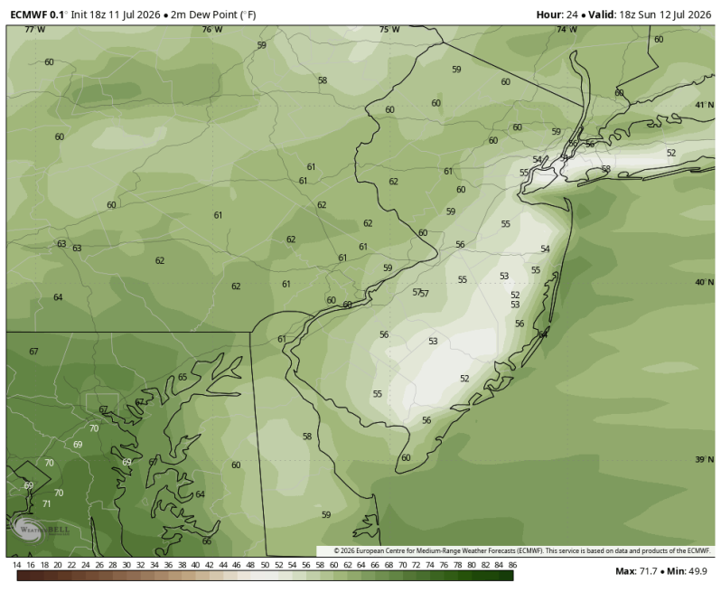
The image above is a look at the lowering dewpoints Sunday afternoon. It will feel much better out there combined with the sea breeze.
Weather Summary
Saturday saw another intense round of downpours and thunderstorms across the Delaware Valley. Extensive flash flooding and wind damage struck portions of western Philadelphia County as well as extreme southern Montgomery County. Closer to the beach, downpours produced minor flooding in some areas west of the Garden State Parkway with Doppler radar estimates over 4″ in Wharton State Forest.
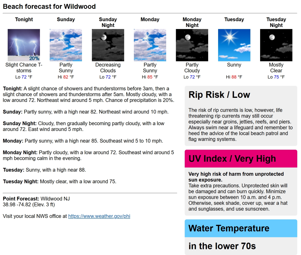
Thankfully, conditions settle down nicely for the second half of the weekend. Not only will beaches see the return of sunshine, but lower dewpoints and a comfortable sea breeze will greet beachgoers as well. Sunday will be a much nicer day up and down the coast from Cape May to Belmar! Enjoy!
Beach Forecast
UV Index: Very High
Temperature: 80
Winds: NE 5-15 mph
Rip Current Risk: Low
Ocean Temperature: 70
Boating Forecast
Winds: E 10-20 kts.
Seas: 3-4 ft. (bumpy)
High Tide Times
Beach Haven Coast Guard Station: 7:45am
Atlantic City: 4:56am, 5:30pm
Ocean City: 5:54am, 6:24pm
Cape May Harbor: 5:30am, 6:03pm
Dewey Beach: 5:56am,6:53am
Fortescue: 6:56am,7:32pm