Weather Summary
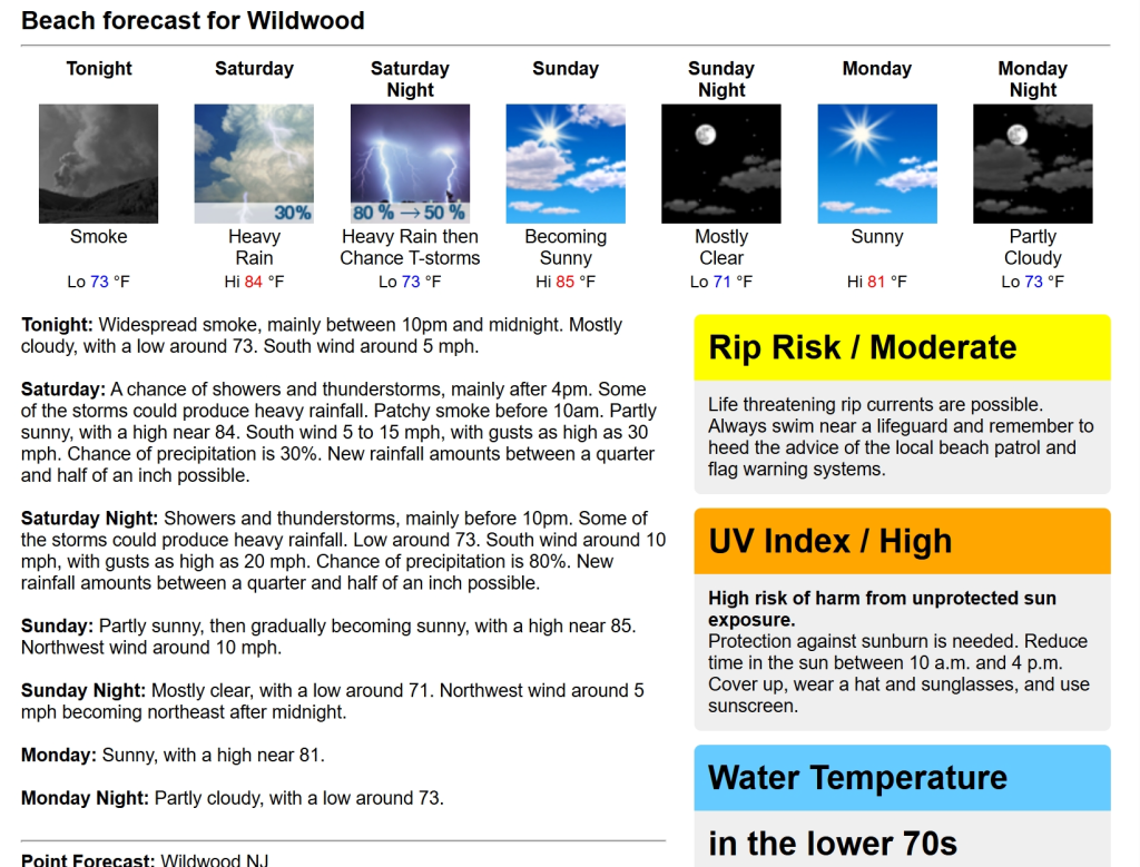
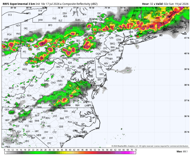
If you’re heading to the Jersey shore on Saturday, I’d plan on getting to the beach early. Even though there could be a round of showers and downpours early in the morning, there will be a period afterwards that should offer the best opportunity to squeeze in some beach time. Although I’m sure how much sun there will actually be. The atmosphere becomes increasingly unstable during the afternoon. As the day wears on, heat and humidity will build, setting the stage for scattered to numerous thunderstorms. Some of these storms could become severe, producing damaging wind gusts, torrential downpours that lead to localized flash flooding, frequent lightning and even an isolated tornado.
Beachgoers should keep a close eye on the sky and have a way to receive weather alerts. If thunder is heard, head off the beach immediately, don’t wait until the rain starts. Conditions can deteriorate quickly, especially during the mid to late afternoon and evening. While the day won’t be a total washout (not even close actually), expect interruptions from thunderstorms and be prepared to cut your beach plans short if warnings are issued.
The good news is once the cold front moves offshore, Sunday looks much nicer with low humidity, plenty of sunshine and a much better beach day.
Beach Forecast
UV Index: Moderate/ High (can we break out into any sunshine?)
Temperature: 84
Wind: S 5-15 mph, Gusts to 25 mph.
Rip Current Risk: Moderate
Ocean Temperature: 73
Boating Forecast – Small Craft Advisory Issued
Winds: S 15-25 kts., Gusts to 30 kts.
Seas: 2-4 ft., building to 4-5 ft. during the day
High Tide Times
Barnegat Inlet: 10:52am
Atlantic City: 10:37am
Ocean City 9th St. Bridge: 11:25am
Townsend Inlet: 11:09am
Cape May Harbor: 11:10am
Bethany Beach: 11:41am
Fortescue: 12:33pm