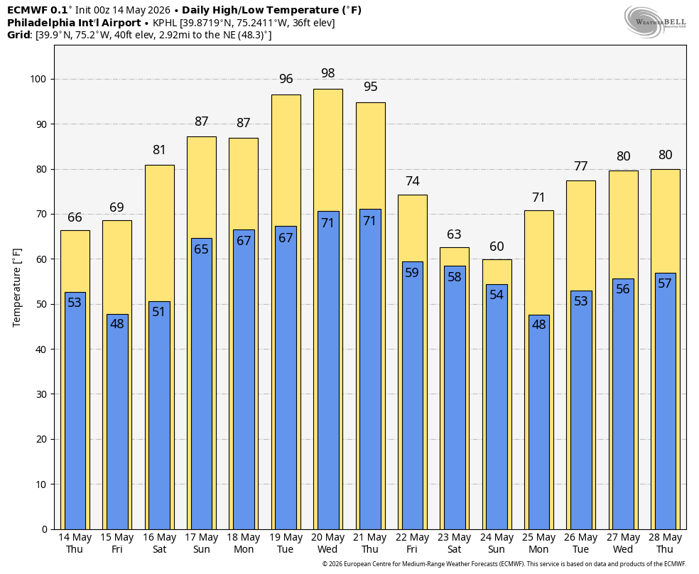
The hottest temperatures of the year so far are on the way next week! Thankfully, the humidity shouldn’t be all that bad. But considering how cool it’s been recently this is going to be a shock to the system if you know what I mean. As of this writing the long-range global models (ECMWF, GFS) have been showing at least two days in the low to mid 90s (Tuesday, Wednesday) with the potential of a third day depending on the timing of a cold front.
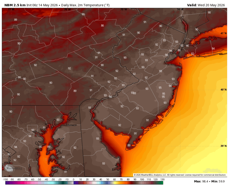
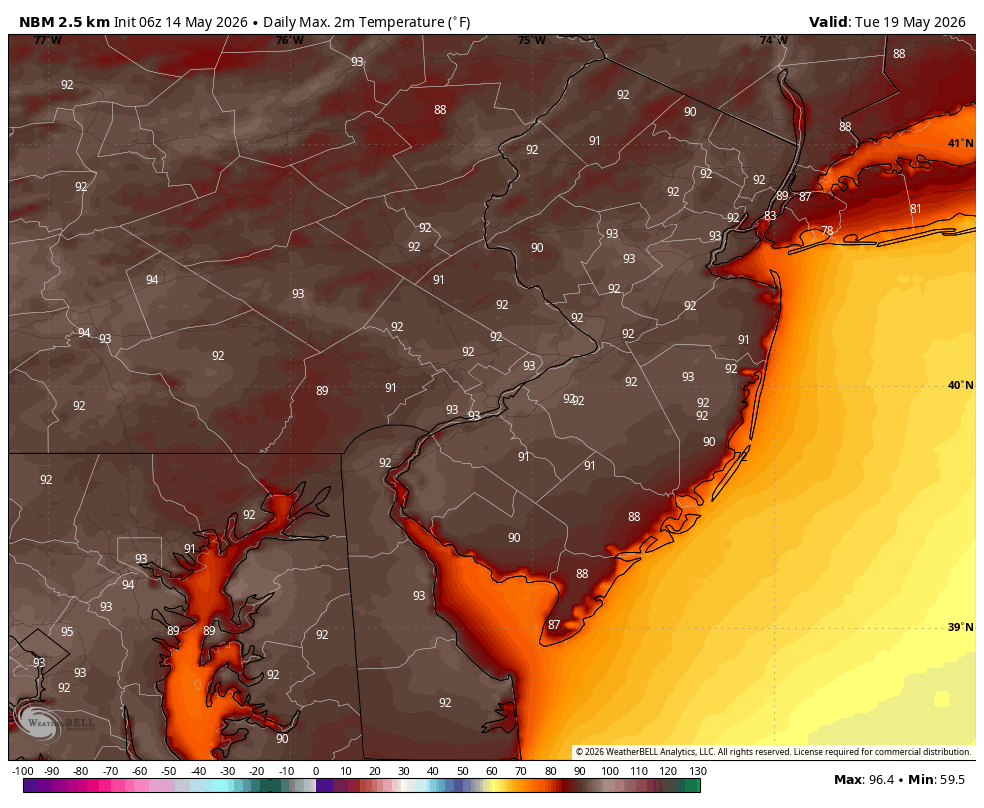
HIGHS TUESDAY & WEDNESDAY
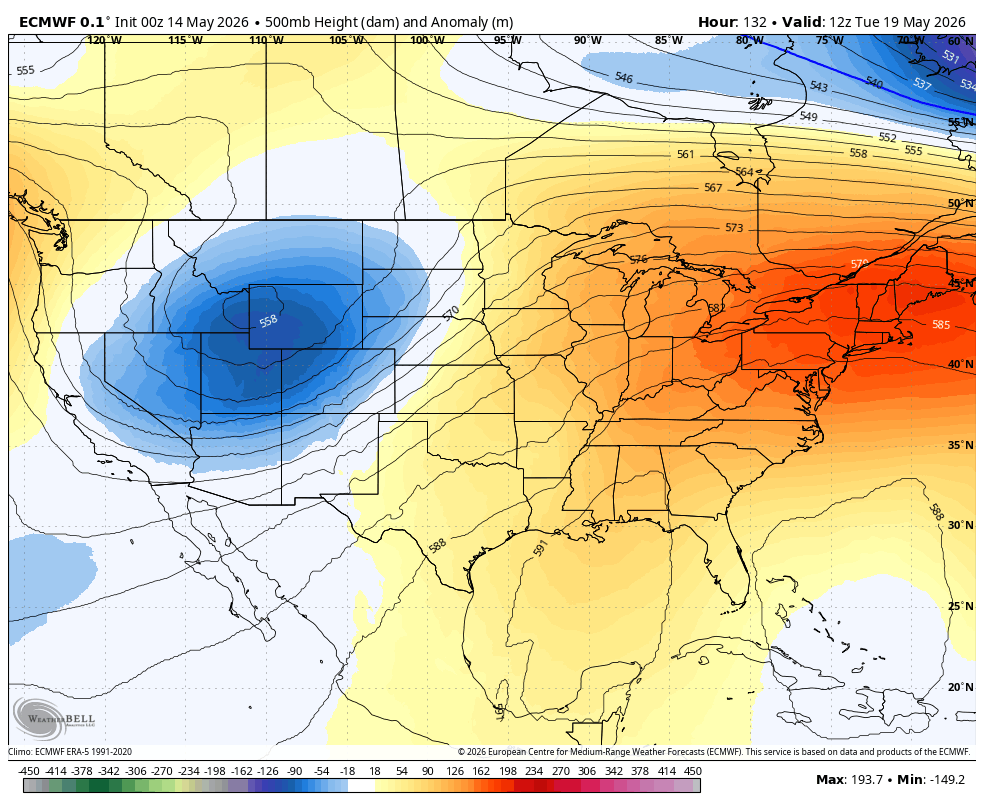
Up to this point the overall weather pattern across the lower 48 has been for a trough, or dip in the jetstream, to persist in the east with a massive ridge out west. Or in other words, a cool pocket of air in the east, heat dome out west. Next week the pattern flips.
NEXT WEEKS UPPER AIR PATTERN = RIDGE IN THE EAST, TROUGH OUT WEST
Some of the forecast guidance, mainly the European model (ECMWF) is going absolutely nuts. Take a look at the meteogram below for Philadelphia. Now the ECMWF does tend to go overboard from time to time so this is not the say all be all. But it does show how hot it could potentially get.
EXTENDED FORECAST – ECMWF METEOGRAM