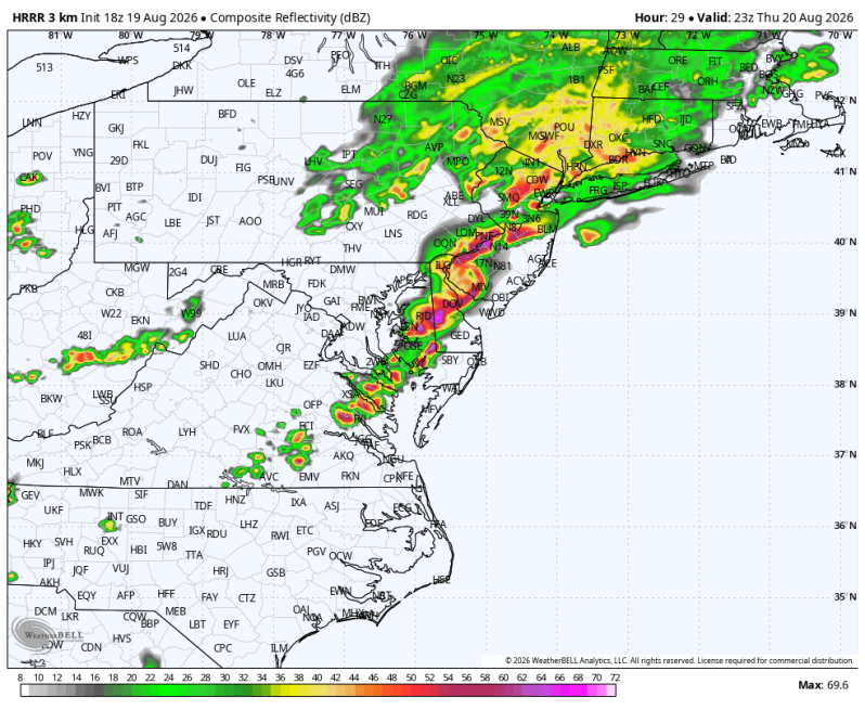
The image above is a look at what the radar may look like around 7pm across the Mid-Atlantic and portions of the Northeast. Notice the intense line of thunderstorms stretching from New York City to Richmond, Virginia.
Weather Summary
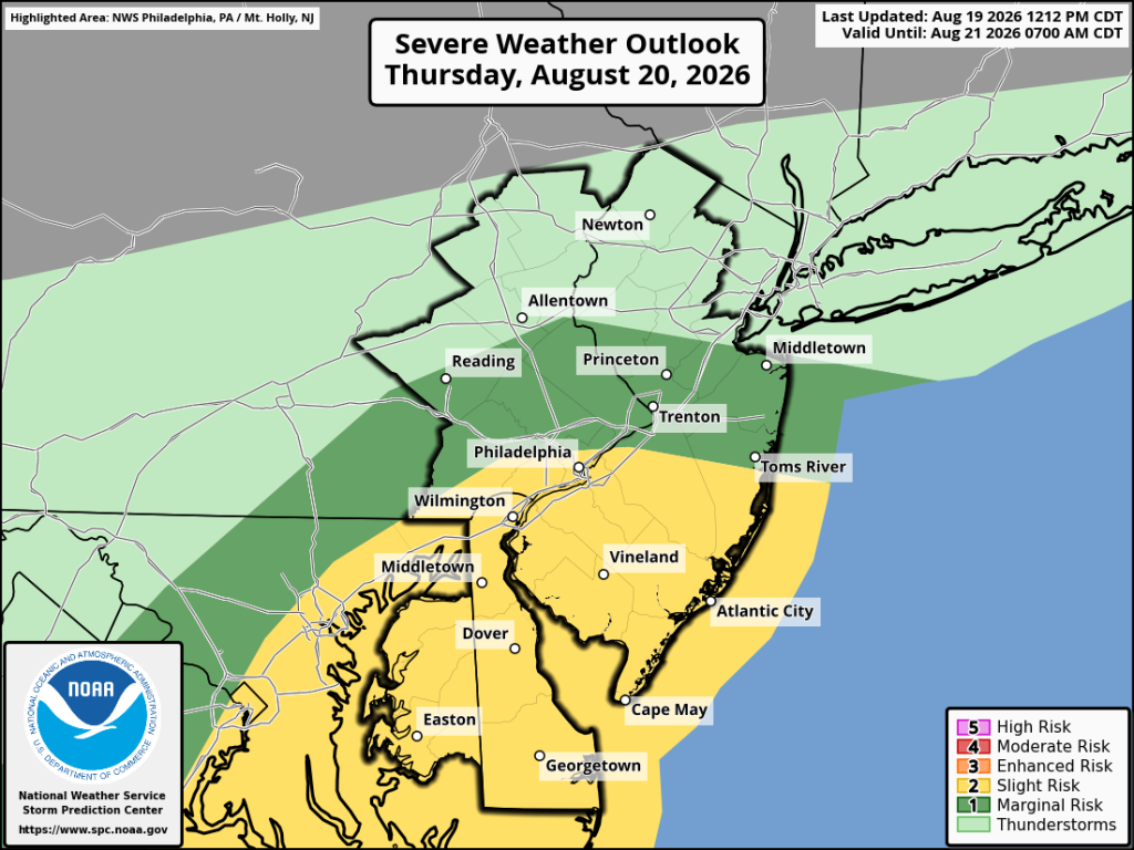
A cold front will approach from the northwest Thursday afternoon. This will potentially set the stage for some fireworks later in the day. Especially considering the shear the CAMs data (Convection Allowing Models) is currently showing. The main concern is for strong, straight-line winds. However, if the shear continues to increase with future model updates there may end up being a tornado threat to deal with too.
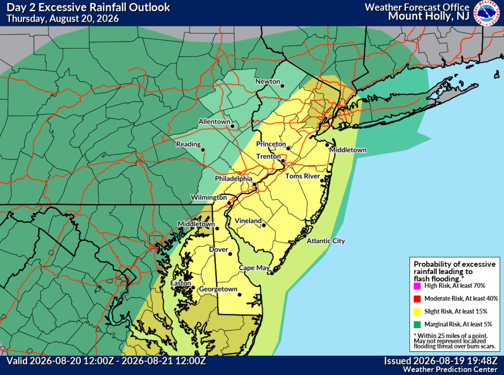
The other concern is flash flooding. The National Weather Service has issued a Flood Watch for most of the viewing area from Thursday afternoon through late Thursday night. Multiple rounds of showers and heavy thunderstorms are expected. Most locations will see a general 1-2 inches of rain when all is said and done. But some areas could pick up 3-5 inches. The rainfall rates could be really high too. Potentially 1-3 inches per hour. Keep an eye on smaller creeks and streams, low lying areas and areas of poor drainage.
Timing: 2pm-10pm