Weather Summary
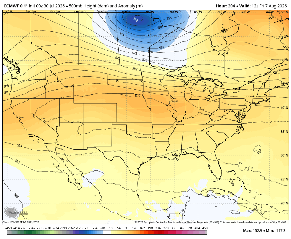
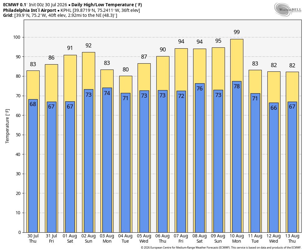
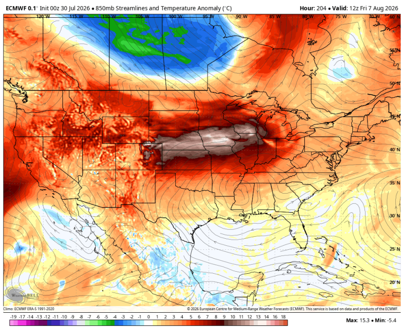
The pattern looks pretty interesting as we open up the month of August. Temperatures will likely start out pretty comfortable during the first few days. But could we be looking at another surge of intense heat a little farther down the road? If we do end up seeing another round of intense heat, it doesn’t look like it will last too long. Maybe four or five days. But what’s going to be interesting here is how much of this ridge out west stretches east into our neck of the woods. The more of a stretch we see, the more intense the heat will be. It seems that’s been the overall pattern this summer. The heat builds out west and then stretches east from time to time.
The good news is it looks like the heat is short lived as another impressive trough (pocket of cool air) drops down from Canada and puts us back into the comfort zone!
The two images below are a look at the overall upper-level pattern showing the coast-to-coast ridge from California to New Jersey and the 15-day ECMWF meteogram for Philadelphia.