Weather Summary
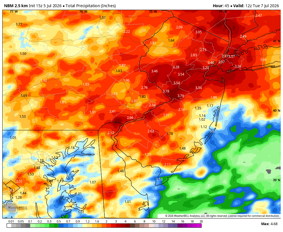
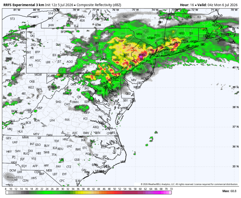
Heavy downpours and thunderstorms over the next 48 hours will lead to pockets of flash flooding over the next couple of days. Especially urban locations and areas of poor drainage. As of this writing, the greatest probability of seeing that kind of weather is north of the Pennsylvania Turnpike and west of the Delaware River. This is an area that has been hit pretty hard recently with heavy downpours. Therefore, the ground isn’t as dry out there as it’s been. The terrain is also very rocky.
With repeated round of showers and thunderstorms expected, even locations that don’t typically flood could experience issues if heavy rain falls in a short period of time. Stay weather-aware and use extra caution while traveling during period of torrential rainfall.
Unlike river flooding, flash flooding develops rapidly, often within minutes of intense rainfall, catching many people off guard. Low-lying areas, areas of poor drainage, small streams and roadways that frequently collect water will be especially vulnerable. Just a few inches of fast-moving water can knock a person of their feet, while a foot of water can sweep away a vehicle. Most flood-related deaths occur when drivers attempt to cross flooded roads.
If you encounter a flooded roadway, remember the phrase: “Turn Around, Don’t Drown.” Water depth can be difficult to judge, especially at night and the road underneath may be washed out. Never drive around barricades or through standing water either.
National Blend of Models – Precipitation Totals; A general 2-3″ of rain with isolated heavier amount to 5 or even 6 inches.