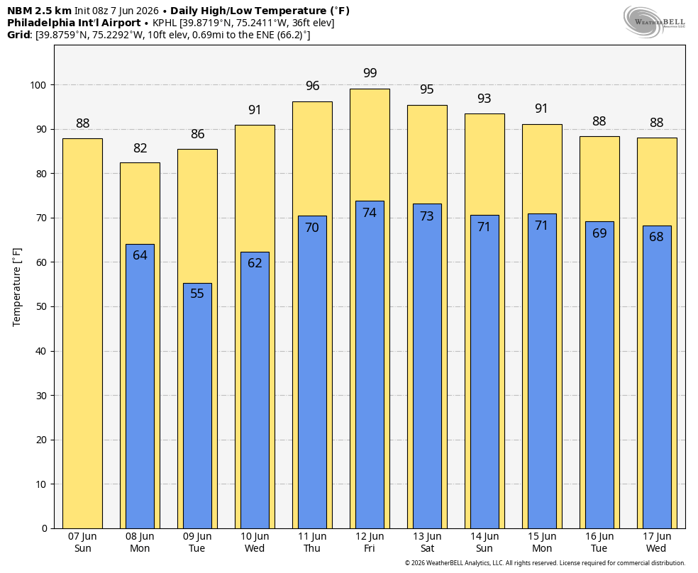
Weather Summary
After a brief break from the heat over the next few days, temperatures are expected to skyrocket across the Philadelphia area later this week. Another strong ridge will settle in over the eastern half of the United States. High temperatures are forecast to climb up into the 90s as early as Wednesday and could potentially peak in the mid to upper 90s by Thursday and Friday. Combined with increasing humidity, it will feel even hotter at times, especially in urban areas where the heat tends to linger. A Heat Advisory will likely be issued at some point should the current forecast verify.
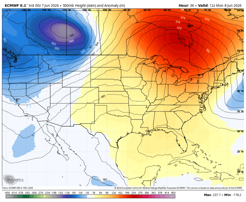
What’s interesting so far this year is the source region of the heat. We’re really not seeing your traditional “Bermuda High” type setups. These building ridges have actually been coming from eastern Canada. The significance there is yes, it gets hot! But we’re not seeing the oppressive amounts of humidity since the source region is continental as opposed to maritime. So we’re catching a bit of a break. Regardless though, its’ going to get pretty hot out there again!
This could potentially be our third heat wave of the year, and it isn’t even officially summer yet. Summer begins June 21st. So just 14 days to go.
Extended Forecast: NBM (National Blend of Models)