June is usually a fairly quiet month in the Atlantic hurricane season. On average (based on the current 1991-2020 climate normals), June produces about 1-2 named storms, but most fail to strengthen into hurricanes. A major hurricane (category 3+) is very rare. Historically, June accounts for only a small fraction of the season’s total activity. Activity starts to ramp up a little bit in July, picks up more noticeably in August and then peaks from late August through September.
Most June storms form in the Gulf, western Caribbean or the waters just off the southeast coast of the United States. The tropical Atlantic and MDR (Main Development Region) are typically still too cool and hostile (Sarahan dust and wind shear) for significant development.
A rough way to think about it:
“June, too soon.
July, stand by.
August, look out you must.
September, remember.
October, all over.”
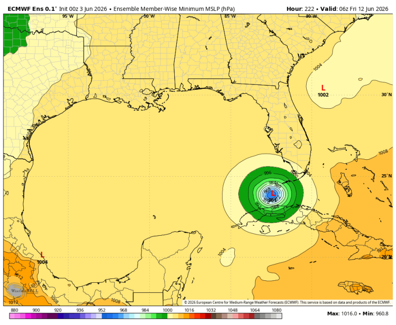
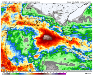
With all of that being said, we’re looking at a developing El Nino this year which will likely limit tropical activity during the heart of hurricane season. Conditions are ripe, however, for an early season storm. We’ve been focused on the first two weeks of June now for quite some time. The ECMWF continues to hint at something possibly developing in the middle of Gulf later this week.
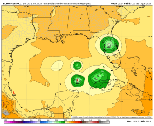
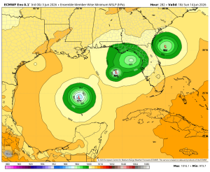
In addition, the ECMWF ensemble below continues to show multiple hot spots during the middle and end of next week. Each area of green represents where the ensemble thinks low pressure may develop during that particular time. It does not mean we’ll see three or four different storms all at the same time. Simply put, the model is trying to figure out where to place this area of low pressure. We’ll have to keep a close eye on things.