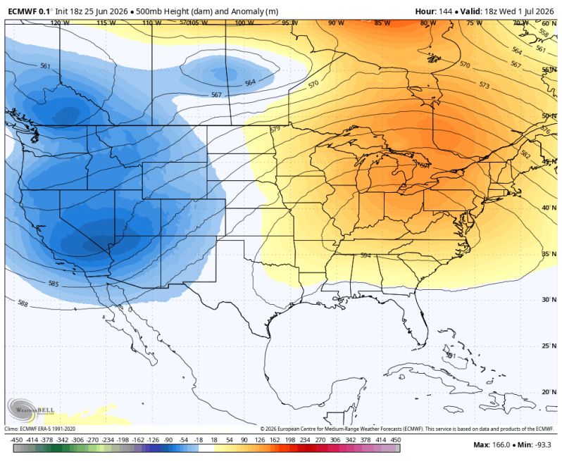
The image above is what the upper-level pattern is going to look like by the middle of next week. A huge heat pump ridge over the eastern half of the United States. There’s a shot we hit 100 degrees, heat index between 105-110!
Weather Summary
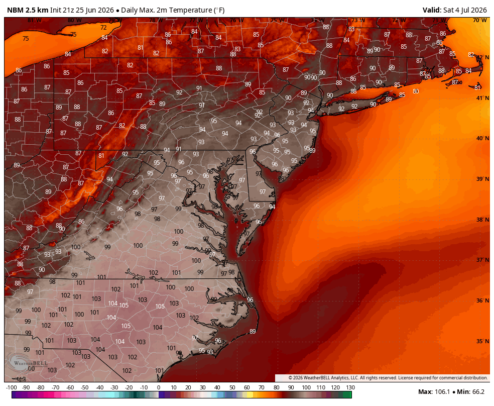
The heat wave is going to be the big story next week as a huge ridge develops in the east. It will break down, but not until at least 6 or 7 days’ worth of 90s first. July is historically the hottest month of the year across the country. We often talk about the dog days of August, but it’s July when the worst of the heat usually arrives!
When we look at next week, it’s very possible the heat wave will officially begin on Monday. Some of the computer guidance has PHL International at 90 degrees Monday afternoon. So, we may end up seeing 90s the entire week. Literally all 7 days! The good news is the humidity really doesn’t get terrible until Wednesday afternoon. It will be moderately humid Monday and Tuesday. But Wednesday is when the humidity really kicks in! Expect steam bath conditions Wednesday and Thursday!
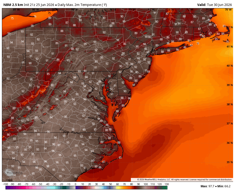
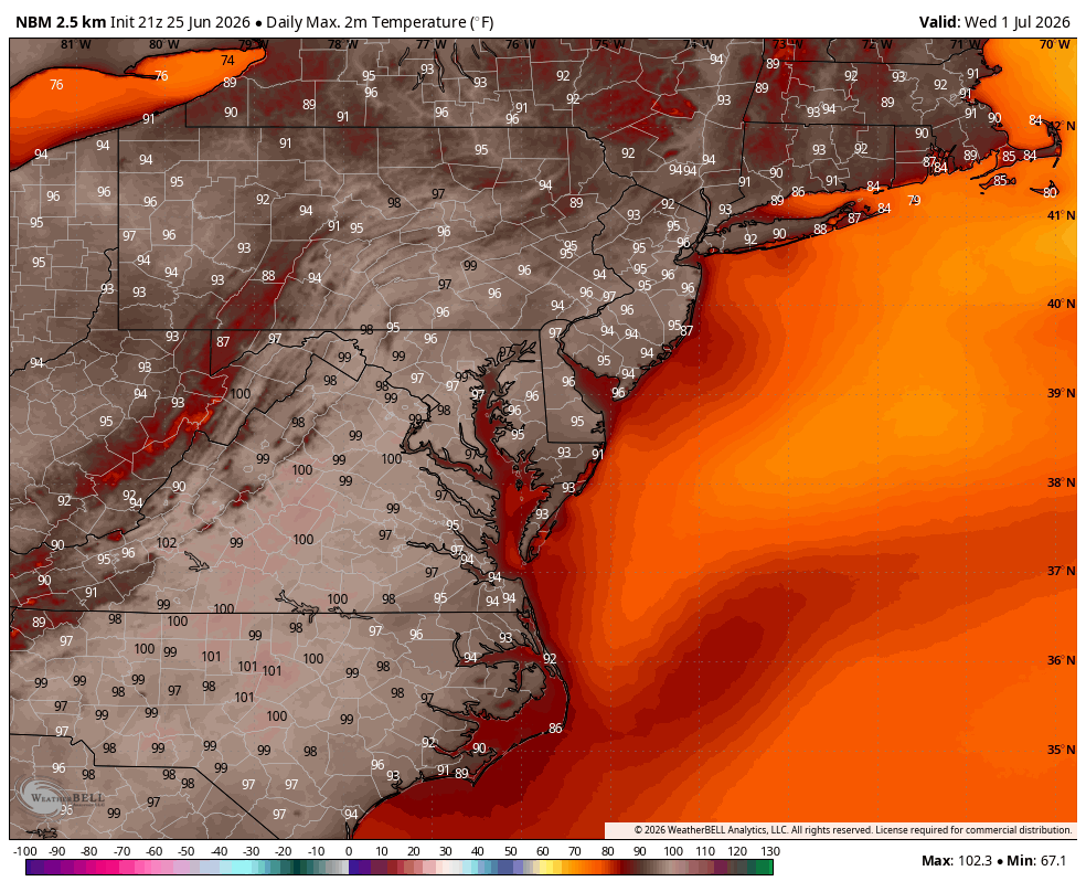
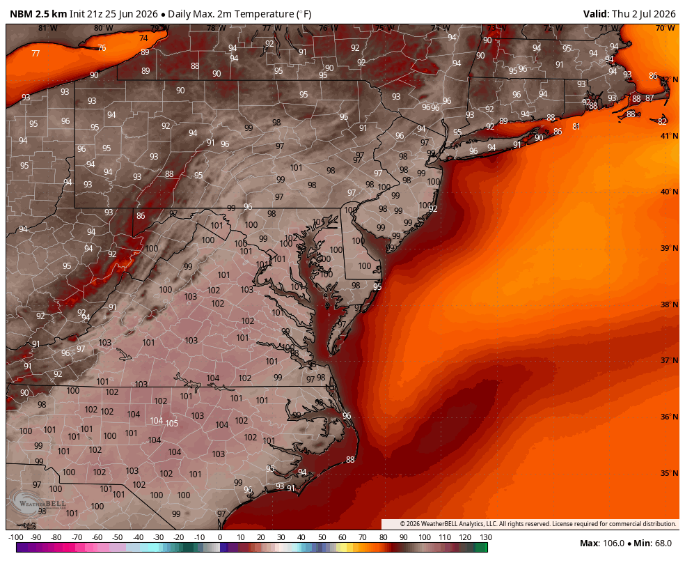
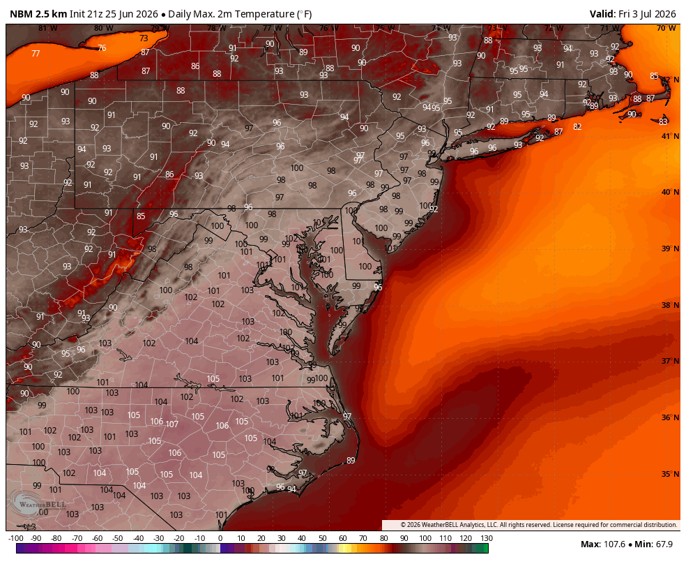
Below is a look at high temperatures next week. Keep in mind Wednesday and Thursday’s heat indices will be well over 100 degrees! Heat alerts will be issued at some point.
Highs Temperatures Tuesday
Highs Temperatures Wednesday
Highs Temperatures Thursday
Highs Temperatures Friday
Highs Temperatures Saturday