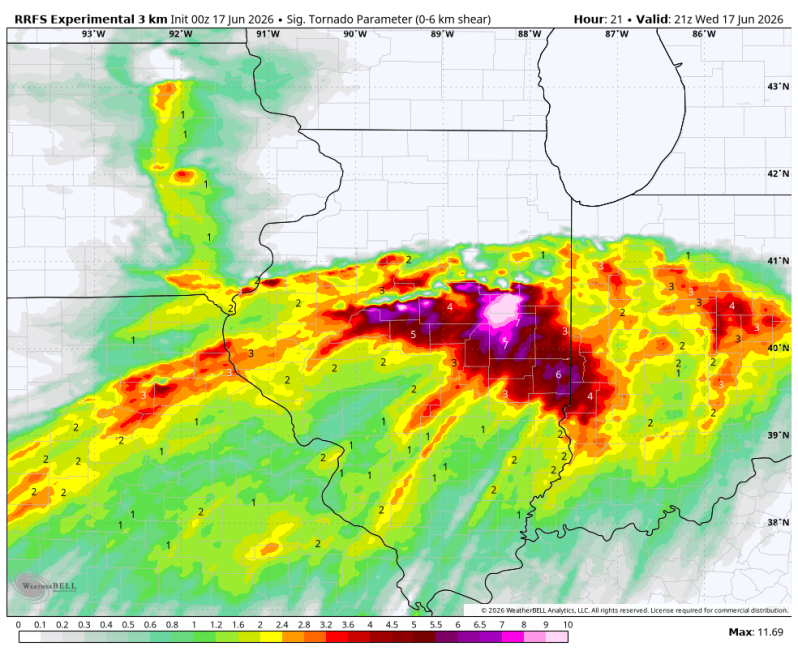
Wednesday is going to be one of those days where you just hope the atmosphere doesn’t reach its full potential. Frightening severe weather parameters are showing up across Illinois and Indiana with Sig. Tornado Parameter numbers literally off the charts in some locations. This is a tornado-driven level 4 out or 5 setup that has been issued by the Storm Prediction Center. At this level, numerous strong tornadoes are possible, damaging straight-line winds potentially over 80 mph and very large hail.
Historically, many of the region’s more impactful severe weather outbreaks have occurred on level 4 risk days. While not every location gets hit, the atmosphere is supportive of significant severe weather somewhere within the risk area.
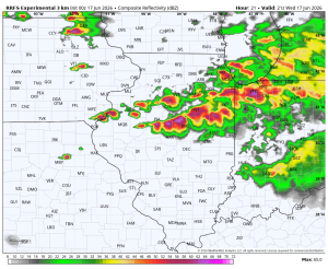
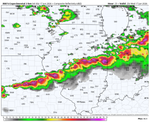
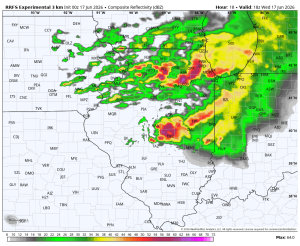
Below is a look at what the RRFS thinks the radar will look like Wednesday afternoon. Scary stuff!
11:00am 2:00pm
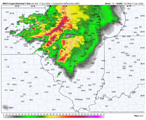
5:00pm 7:00pm